
Review · ALPINE FLIGHTS & HELI-LANDINGS
Wānaka: Scenic Helicopter Flight Wānaka Max
Above Wānaka, the mountains start talking. This Wānaka Max helicopter flight is interesting because it turns big scenery into something you feel in your bones: a short ride that includes two alpine landings plus a tight circuit over signature valleys and lakes.
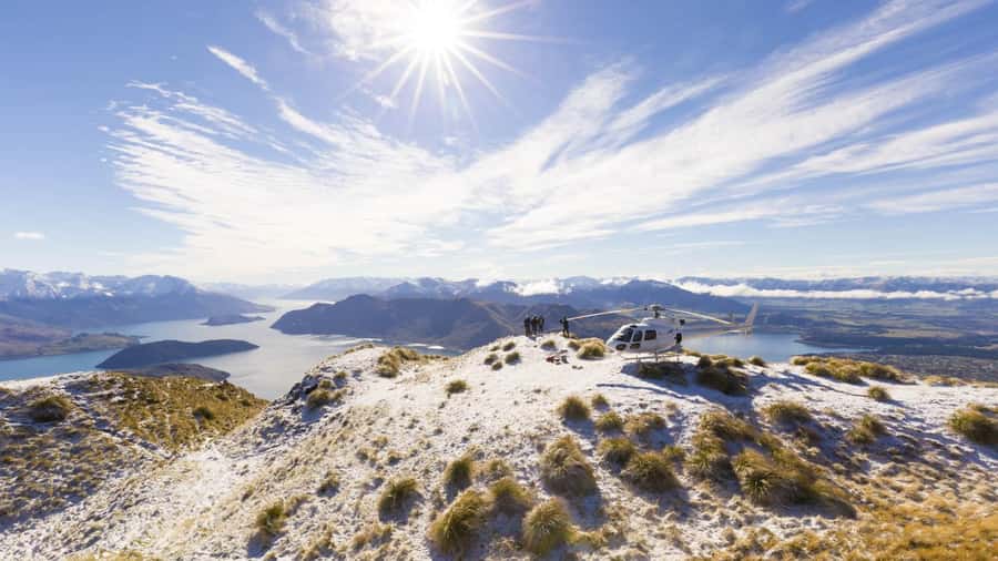
What I really like is the chance to actually touch down at a mountain viewpoint, not just cruise overhead, and the way the scenery keeps changing during those drops and climbs.
The second thing I like is the English live tour guidance, which helps you make sense of what you’re seeing as the pilot points out the main features in real time (and you get great photo opportunities while you’re at it). One consideration: the Coromandel Peak / Mt Roy landing is listed as if available, and weather can also force postponements or changes.
In This Review
- Key things that make Wānaka Max special
- Wānaka Max flight in 45 minutes: what you’re really buying
- Where it starts: Wanaka Helicopters office and what to prepare
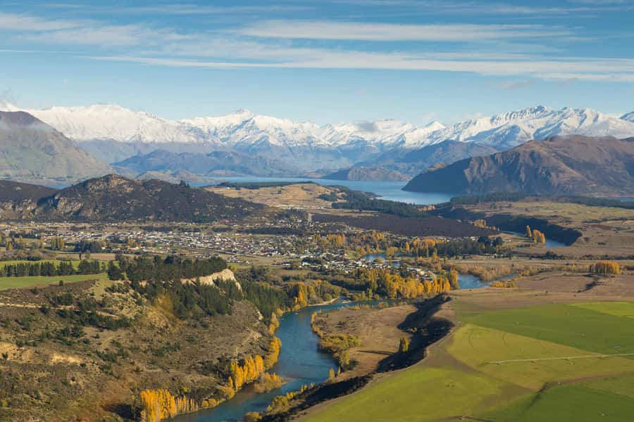
- Matukituki River: seeing the valley structure instead of just the view
- Coromandel Peak / Mt Roy landing (if available): the 4,000-foot moment
- Mou Waho Island: the lake-within-a-lake aerial effect
- Mt Aspiring National Park: snow-capped peaks and glacier-carved valleys
- Lake Hāwea and Stevensons Arm: the contrast circuit
- The pilot makes it: guidance in English and photo-friendly moments
- Price and value: is $298 worth a helicopter for 45 minutes?
- Who should book Wānaka Max, and who might skip it
- Should you book this scenic helicopter flight?
- FAQ
- How long is the Wānaka Max helicopter flight?
- How much does it cost?
- Where do I meet for the flight?
- What’s included in the Wānaka Max experience?
- Are meals and drinks included?
- Is the Coromandel Peak / Mt Roy landing guaranteed?
- What views will I see during the flight?
- Is there a guide, and what language is it in?
- What should I know about access and rules?
- What happens if weather affects the flight?
Key things that make Wānaka Max special
- Two alpine landings: you go beyond sightseeing from the air and get real touchdown moments
- Coromandel Peak / Mt Roy (if available): the iconic 4,000-foot viewpoint payoff
- Matukituki River valley views: a dramatic corridor between peaks and native bush
- Mou Waho Island’s lake-within-a-lake look: a rare aerial pattern you can’t unsee
- Mt Aspiring National Park from above: snow-capped peaks and glacier-carved valleys in one sweep
Wānaka Max flight in 45 minutes: what you’re really buying
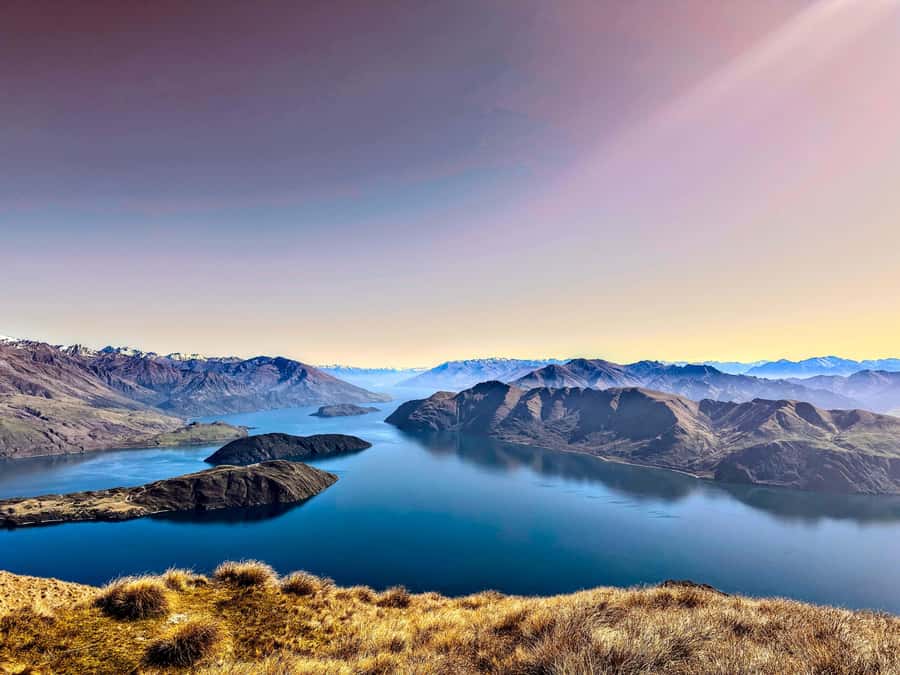
At $298 per person for 45 minutes, you’re not paying for a long ride. You’re paying for concentration: a short window when your camera, your eyes, and your sense of scale all get hit at once. The design of the Wānaka Max experience focuses on variety, with aerial views that shift from river valley to alpine summits to named lakes and arms.
The real value is that you get two alpine landings. Most scenic helicopter flights stop at takeoff-and-overhead views. Here, the touchdown moments break the flight into chapters, and that makes the time feel longer and more meaningful than a straight pass over the scenery.
Other scenic flights and alpine heli-landings over the peaks
- Wanaka: Scenic Helicopter Flight with Glacier Experience
★ 5.0 · 42 reviews - Wānaka: Scenic Helicopter Flight Wānaka Max
★ 5.0 · 11 reviews - Wānaka: Heli Siberia – Helicopter Flight, Hike & Jet Boat
★ 4.6 · 4 reviews
Where it starts: Wanaka Helicopters office and what to prepare
Your meeting point is the Wanaka Helicopters Office. Plan to arrive with a little buffer so you’re not rushing through check-in. One practical note: the experience includes skip-the-ticket-line, which helps if you’re trying to keep your day moving and still fit this flight in before or after other Wānaka activities.
For what to wear, the data doesn’t spell out a dress code. But helicopters tend to feel cooler and breezier than you expect at altitude, so I’d go with layers. Also, keep your phone/camera secured for the ride—quick lifts and landings mean you want your hands free only when you’ve chosen the exact moment.
And yes, there’s no smoking allowed, so keep that in mind for anyone in your group who might be tempted to step outside.
Matukituki River: seeing the valley structure instead of just the view
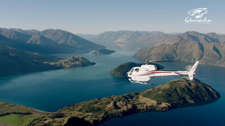
The flight begins building your sense of the region with a glide above the Matukituki River. What makes this stretch special is that you can read the terrain: river lines, the width of the valley, and how the mountain walls shape where water and forests can go.
From above, you also get a clearer view of how the valley fits into the wider Wānaka story. This is the kind of scenery where, from the road, you might see a waterfall or a bend. From the air, you see the whole system—river corridor, slopes, and the way the peaks frame it.
If you’re the type of traveler who loves understanding place rather than just collecting photos, this river segment is one of the smartest parts of the itinerary.
Coromandel Peak / Mt Roy landing (if available): the 4,000-foot moment
Touch down at Coromandel Peak – Mt Roy (if available) is listed as a key feature—and it’s the part that people most often describe as the highlight. The viewpoint is at 4,000 feet, and that elevation matters because it changes what your eyes can compare at once: Lake Wānaka, the township, and the broader region beyond.
Here’s the practical payoff of a landing: when you’re on the ground, you can spend a few extra seconds composing photos and letting the view settle in. From a helicopter window, things move fast. At a landing spot, the experience gives you a pause—enough time to capture the shot you actually want.
The only “but” is the landing is conditional. Since it’s listed as if available, treat it like a bonus that might happen, not a guaranteed checkbox.
Mou Waho Island: the lake-within-a-lake aerial effect
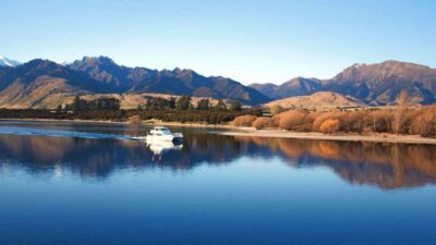
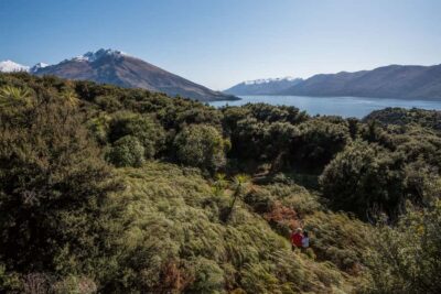
Then comes a visually weird and wonderful moment: Mou Waho Island, a protected Nature Reserve, viewed from above as a lake within a lake. That phrasing is doing work. From certain angles, it’s not just “there’s water surrounded by land.” It’s more like an extra layer of water appears inside the larger one, creating a shape you won’t fully get from ground-level viewpoints.
This is also one of those scenes that rewards still attention. If you look away for even a short moment, the pattern can be hard to remember. If you like photo challenges, this is a good target: you’ll want to frame where the inner water sits relative to the outer edge.
If you’re traveling with someone who usually rolls their eyes at scenic descriptions, this is the one that tends to win them over quickly.
Mt Aspiring National Park: snow-capped peaks and glacier-carved valleys
One of the itinerary’s big-ticket aerial sections is Mt Aspiring National Park, a World Heritage-listed area in the information. You’re promised dramatic snow-capped peaks and ancient glacier-carved valleys from above.
What I like about covering this area by helicopter is that it turns “big mountain country” into something legible. Glacier-carved valleys can look like generic steep slopes from a viewpoint on land. From the air, you can often see the shape of the valley walls and the way the terrain was shaped over time.
Also, this part of the flight gives you a mood shift. You go from identifiable features like lakes and rivers into higher, sharper terrain, where snow patterns and valley geometry become the main story.
Lake Hāwea and Stevensons Arm: the contrast circuit
Near the end, the flight shifts to a set of named waterways: Lake Hāwea and Stevensons Arm. The experience is described as taking in the contrast between these areas from above, and then guiding you through Stevensons Arm with mesmerizing views of Lake Hāwea before completing the circuit back toward the airport.
This “contrast circuit” idea is why the route feels more complete. Lake Hāwea isn’t just “a lake.” It’s a body of water that changes how the surrounding land reads—dark inlets, lighter shorelines, and the way the arms slice into the region. That’s what makes aerial views so good here: the water geometry becomes the map.
If you’re into photography, this section is practical too. Big water surfaces can be forgiving for wide shots, while the edges and arms are great for tighter framing.
The pilot makes it: guidance in English and photo-friendly moments
A scenic helicopter flight lives or dies by the pilot’s ability to both fly well and narrate the view. The information confirms there’s a live tour guide in English. In the experience, pilots also help point out key features as you go.
One name that came up is Travis, praised for being an excellent guide and pilot who pointed out special points during the flight. You should also expect a similar vibe even if your pilot is someone else: the guidance is what turns random hills into named, meaningful places.
For photos, your best strategy is simple:
- Think in shots, not in seconds. Decide what you want (wide lake, river corridor, mountain landing).
- Listen for cues in the English commentary, then grab your photo at the exact moment the feature lines up.
- Keep your expectations realistic. Through a helicopter window, you’ll get great images, but you may not get perfectly crystal-clear shots every time.
Because the flight is only 45 minutes, the pilot’s timing matters. A good guide helps you focus your attention where the views are strongest.
Price and value: is $298 worth a helicopter for 45 minutes?
Let’s talk value without the sugar. At $298 per person, this isn’t a budget activity. But it’s also not a full-day helicopter commitment. You’re paying for:
- Short duration with high visual payoff
- Two alpine landings, not just sightseeing from the air
- A guided experience in English
- Scenic coverage that includes multiple named regions: river valley, island reserve, national park, and lake/arm circuit
If your trip already includes a few driving-heavy days, this can be a cost-effective way to buy a brand-new perspective without losing a half day to roads and stops. It also works well if your travel style is “one iconic thing done properly.”
If you’re extremely cost-sensitive or already getting similar views from viewpoints on the ground, then helicopter time might feel expensive for what you already know. But if you want the aerial scale—especially the Mt Roy landing if available—this is one of the few ways to do it in a compact block.
Who should book Wānaka Max, and who might skip it
This flight fits best if you:
- Want a big scenery payoff without spending all day in transit
- Care about landmarks with names: Matukituki River, Mou Waho, Mt Aspiring, Lake Hāwea, Stevensons Arm
- Like photo opportunities where the scenery actually changes as you move
It’s also listed as wheelchair accessible, which is a real advantage if you’re dealing with mobility limits and still want an experience that doesn’t depend on lots of walking.
You might choose a different activity if:
- You’re going through a period of weather uncertainty and the idea of a possible change stresses you out
- You’re mostly satisfied with ground viewpoints and don’t care about aerial patterns or alpine touchdown moments
Should you book this scenic helicopter flight?
I think Wānaka Max is a strong choice if you want your Wānaka trip to include something you can’t replicate from a lookout. The combination of two alpine landings, including Coromandel Peak / Mt Roy (if available) at 4,000 feet, plus the aerial set pieces over Mou Waho and Mt Aspiring National Park makes the flight feel like more than a ride.
My decision rule is simple: if you’ll be disappointed missing the chance at Mt Roy, then book with eyes open about the if available landing and the fact that weather or pilot availability can affect timing. If you’re okay treating it as a chance to see Wānaka from above with serious highlights, then this is the kind of activity that can become the memory that anchors the rest of your trip.
FAQ
How long is the Wānaka Max helicopter flight?
The duration is 45 minutes.
How much does it cost?
It costs $298 per person.
Where do I meet for the flight?
You meet at the Wanaka Helicopters Office.
What’s included in the Wānaka Max experience?
It includes two stunning alpine landings and breathtaking views of the Wānaka region, with a live English tour guide.
Are meals and drinks included?
No. Meals and drinks are not included.
Is the Coromandel Peak / Mt Roy landing guaranteed?
It’s included if available.
What views will I see during the flight?
You’ll see views of the Matukituki River, Mou Waho Island (noted for the lake-within-a-lake view), Mt Aspiring National Park, and the contrasts of Lake Hāwea and Stevensons Arm.
Is there a guide, and what language is it in?
Yes, there is a live tour guide in English.
What should I know about access and rules?
The experience is listed as wheelchair accessible, and smoking is not allowed.
What happens if weather affects the flight?
The operator may need to cancel or postpone due to weather or pilot availability, and they confirm your flight time by their team within 24 hours of your booking.
More Time Over the Peaks
- Wanaka: Scenic Helicopter Flight with Glacier Experience★ 5.0 · 42 reviews
- Wānaka: Heli Siberia – Helicopter Flight, Hike & Jet Boat★ 4.6 · 4 reviews
- Wānaka: Helicopter Scenic Flight Wānaka Experience★ 5.0 · 4 reviews
Fresh on the Queenstown pages
Alpine Flights & Heli-Landings, compared.
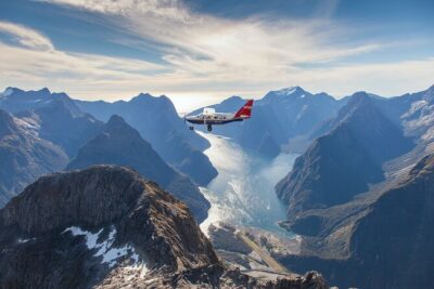 ★ 5.0Milford Sound Small Group Tour from Queenstown with Scenic FlightFrom $557324 reviews
 ★ 4.9Pilot’s Choice Helicopter Tour & Alpine LandingFrom $230291 reviews
 ★ 4.9Glacier Explorer & Earnslaw Burn Helicopter FlightFrom $408202 reviews
 ★ 5.0Half-Day Milford Helicopter Flight and Cruise from QueenstownFrom $887173 reviews
 ★ 5.0Pilot’s Choice Helicopter Flight with alpine landingFrom $245168 reviews
 ★ 4.9Milford Sound Cruise & Helicopter Alpine TourFrom $786165 reviews
 ★ 5.0Southern Glacier 50-Minute Helicopter FlightFrom $547123 reviews
 ★ 4.7Milford Sound Coach, Cruise, Scenic FlightFrom $465113 reviews
Browse the lists this tour appears in